
Map of Reserve area
Where to Stay


What to Do
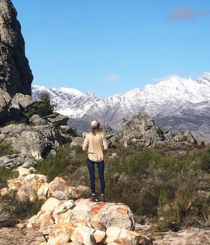
Hiking/Walking
There are numerous options for hiking in the wilderness. Hikes have varying lengths and many provide welcome swimming opportunities. Parts of the greater conservation area, like Sneeugatrivier and the mountain peaks, are true wilderness – showing no traces of human intervention. It is advisable to book in advance as capacity is limited.
Hiking trails
As Groot Winterhoek is a wilderness area, hikers do not have to stick to trails. You can explore the area’s rock formations and caves, and overnight in the veld. Hikers must leave their vehicles at the parking area at the office complex.
To lessen the environmental impact of numerous visitors, the area is divided into two user-zones: Kliphuis and Perdevlei in the east, and De Tronk and Die Hel in the south. The trails do not have route markers, but small cairns show directions where trails lead over plate rock.
Easy to use trail maps for these hiking trails created by Forge can be downloaded here.
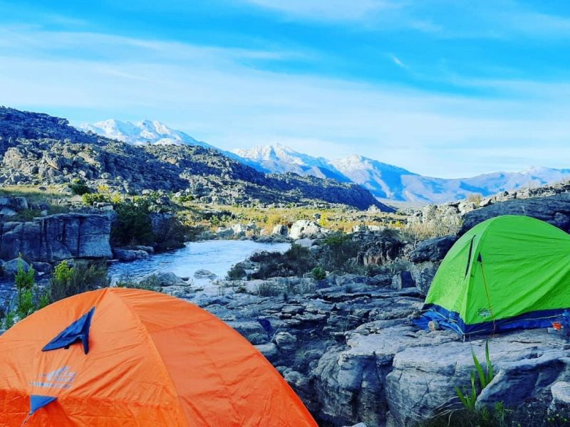
Huts
There is a primitive shelter at Perdevlei that cannot be booked. The huts at De Tronk need to be booked in advance. Open fires are not allowed.
Help us protect nature
No pets/no firearms/no fires/no picking of flowers or collecting of seeds/no rubbish bins – all refuse must be carried out of the wilderness area/no toilets – all waste and toilet paper must be buried with a spade or trowel/do not use soap or shampoo in the rivers and streams.
Permits
Buy your permits through the CapeNature Contact Centre. Permits must be carried at all times. Book early to avoid disappointment!
Please note that the jeep track to De Tronk is closed for vehicles until further notice.
Trail preparation
- Wear comfortable walking shoes, sunscreen and a hat.
- Do not hike alone.
- Carry enough food and water with you.
- Make sure you know what the weather conditions are before you depart.
- Take a warm jacket/raincoat in winter.
- Make sure you have a relevant map of the area.
- Take a field medical kit with you for emergencies.
- Obey all signage.
- Stay in a group and on the trails.
Parking area to De Tronk via jeep track
- Trail distance: 14km
- Estimated time: 3.5 hours
This route is fairly easy, but water is not available for the first 11km, until Weltevrede. Enjoy the beautiful vegetation on this hike, including tolbos, erica and exceptionally large waboom trees. Hikers should not use this route if making their way back to the parking area.
Parking area to De Tronk via river
- Trail distance: 13km
- Estimated time: 3 hours
This route follows the Kliphuis River to the low-water bridge. From there it follows the jeep track to De Tronk. Plenty of water is available and there are lots of swimming pools to cool off in along the way, so bring a swimming costume with you. This trail is surrounded by beautiful patches of ericas.
The Groot Kliphuis River is difficult and dangerous to cross in winter.
Parking area to Protea Pool
- Trail distance: 1.5km
- Estimated time: 40 minutes
This route is easy, taking you through a flat trail before stopping at the small, refreshing Protea Pool. Remember to bring a swimming costume with you. From there you can explore the Groot Kliphuis River.
Keep an eye open for the disas that flower between December and February.
Parking area to Disa Pool
- Trail distance: 2.6km
- Estimated time: 1 hour
This route is easy, taking you through a flat trail before stopping at the small, refreshing Protea Pool. Remember to bring a swimming costume with you. From there you can explore the Groot Kliphuis River.
Keep an eye open for the disas that flower between December and February.
Parking area to Crystal Pool
- Trail distance: 4.11km
- Estimated time: 1.5 hours
This route is easy, taking you through a flat trail before stopping at the small, refreshing Protea Pool. Remember to bring a swimming costume with you. From there you can explore the Groot Kliphuis River.
Parking area to Groot Kliphuis via river
- Trail distance: 9.5km
- Estimated time: 3.5 hours
This easy route follows the Kliphuis River for a short distance before shifting east. The trail winds through exceptional rock formations and passes a wonderful swimming pool as it enters the koppies. Remember your swimming costume. Many ericas and disas grow along this route. Water is plentiful, but in winter the streams can be difficult to cross.
Parking area to Die Hel
- Trail distance: 19km
Estimated time: 4.5 hours
This route follows the Kliphuis River to the low-water bridge. From there it follows the jeep track to De Tronk. From De Tronk, the path leads south under oak trees and over a small footbridge towards Die Hel. The route is easy until you reach the gorge. The descent to the swimming pool is very steep and difficult. Look out for the rock art on an overhang on the left of the footpath as it begins to drop steeply. The pool is very deep and one of the largest in the Western Cape. Remember to bring a swimming costume with you.
De Tronk to Die Hel
- Trail distance: 5km
- Estimated time: 1.5 hours
From De Tronk, the path leads south under oak trees and over a small footbridge towards Die Hel. The route is easy until you reach the gorge. The descent to the swimming pool is very steep and difficult. Look out for the rock art on an overhang on the left of the footpath as it begins to drop steeply. The pool is very deep and one of the largest in the Western Cape. Remember to bring a swimming costume with you.
Groot Kliphuis to Perdevlei via jeep track
- Trail distance: 7km
- Estimated time: 2 hours
This route is fairly demanding but offers magnificent views. Enjoy the stunning fynbos along the trail, particularly the protea, which grows in abundance in this area.
Groot Kliphuis to Perdevlei via river
- Trail distance: 6km
- Estimated time: 1.5 hours
This route leads south, from Kliphuis to the Klein Kliphuis River. From there, hikers turn east (left) to reach Perdevlei. The river usually has water.
Perdevlei to De Tronk
- Trail distance: 12km
- Estimated time: 2.5 hours
This beautiful route follows the Klein Kliphuis River, joining the jeep track leading to De Tronk. Remember to bring a swimming costume with you so that you can plunge into the many swimming pools along the way.
Parking to Perdevlei
- Trail distance: 23km
- Estimated time: 6 hours
The trail winds through exceptional rock formations and passes a wonderful swimming pool as it enters the koppies. It then continues until Groot Kliphuis. Hikers can either turn left to connect to the old jeep track or right to continue via the river. Remember your swimming costume. Many ericas and disas grow along this route. Water is plentiful, but in winter the streams can be difficult to cross.
Pardevlei to de Tronk
- Trail distance: 12km
Estimated time: 2.5 hours
This beautiful route follows the Klein Kliphuis River, joining the jeep track leading to De Tronk. Remember to bring a swimming costume with you so that you can plunge into the many swimming pools along the way.
Step back in time and visit some of Groot Winterhoek’s remarkable examples of San and Khoi rock art. These paintings, found in rocky overhangs and caves, vary between 300 and 6 000 years old. They are an integral part of the wilderness area's value and we encourage you to discover them on your own.
Rock art is protected by the National Monuments Act (1969) and vandals who deface rock paintings face fines of up to R10 000 and/or two years imprisonment.
The greater Groot Winterhoek conservation area is particularly important for protecting mountain fynbos and wildlife. It is also one of Cape Town’s sources of fresh, clean water, and is a World Heritage Site.
This area is rich in history, with ancient rock paintings by the San and Khoi people, and the oldest farm established in 1875. Early settlers in the area used animals to transport produce and supplies between Porterville and Saron. Their tracks are still visible above Driebosch and Weltevrede.
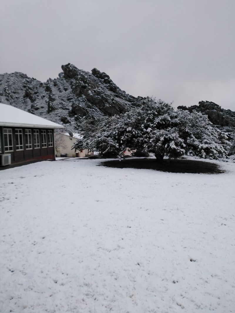
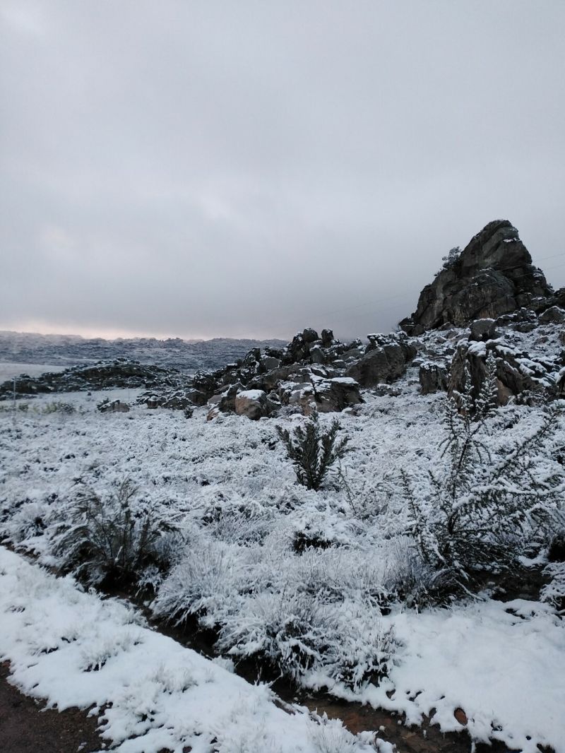
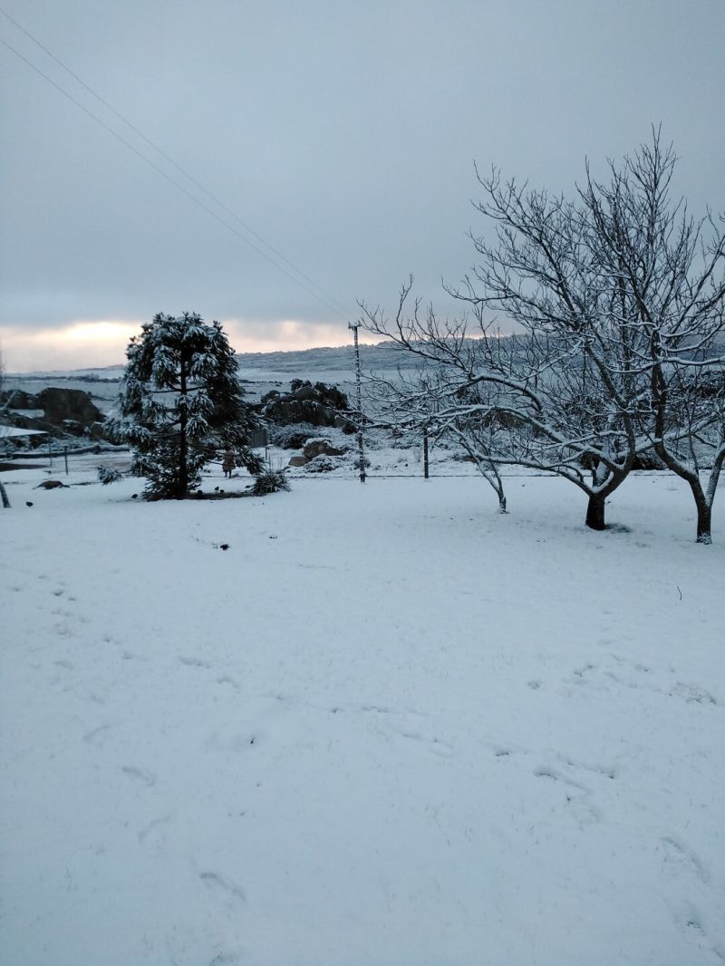
As Groot Winterhoek’s name suggests, winters are cold and wet. Winter nights are very cold, with temperatures below freezing. Summers are moderate, but hikers should always be prepared for sudden cold and mist.
There’s plenty to do in Groot Winterhoek, including various day and overnight hikes, crystal-clear mountain pools and mountain biking.
To find out more, download the Groot Winterhoek Wilderness brochure below.
How to get there
From Cape Town via Piketberg
Travel about an hour-and-a-half up the N7 from Cape Town towards Piketberg. Opposite Piketberg, take the R44 towards Porterville, but instead of going into Porterville at the T-junction, turn left for Cardouw on to what becomes a dirt road and head for the Dasklip Pass. Follow the signs to the office, which is on top of the mountain and about 33 km from Porterville.
From Cape Town via N1 & R44
Travel about an hour-and-a-half up the N1 from Cape Town towards Paarl. Opposite Klapmuts, take the R44 towards Wellington, but instead of going into Wellington at the Traffic lights, turn left towards Ceres. Opposite Gouda, turn left towards Porterville, and drive for 33km. Drive past Porterville for about 2km north of Porterville, turn right on to what becomes a dirt road (Cardouw turn-off) and head for the Dasklip Pass. Travel up the steep Dasklip Pass and follow the sign boards to the office and parking area, which is on top of the mountain and about 33 km from Porterville.
GPS: 32◦. 59' 54,3" S & 19◦ 03' 23, 9" E
General information
Office hours:
- 07h30 –18h00 Monday to Friday
- 07h30 –18h00 Saturdays, Sundays & Public Holidays
Tel: +27 (0)87 087 4047
Accommodation and permit bookings Tel: 087 087 8250
The Groot Winterhoek Wilderness is revered and cherished for its starkly rugged landscape, its atmospheric extremes, and the stunning rock formations created by the weathering of Table Mountain Sandstone. A sense of holiness hangs over the area – visitors come here to be replenished, and to cleanse themselves in the deep, still mountain pools. This mountainous area lies about 120km north of Cape Town, near Porterville, and is particularly important for protecting mountain fynbos and wildlife. It is also one of Cape Town’s sources of clean water and is known as a World Heritage Site. This area is rich in history, with ancient rock paintings by the San and Khoi people and the oldest farm established in 1875. Cape Nature offers a range of accommodations, from the comfortable to the rustic.
What Our Guests Say
Discover affordable self-catering accommodation starting from R690 per day. Enjoy a variety of fun day activities and trails from just R80.
Adults
Day Access = R80; Overnight fee = R60
Children
Day Access = R50; Overnight fee = R35

Visitors Gallery


Other Reserves Nearby
